Aerial Archive
The division for Aerial Photography was incorporated into the Department of Prehistoric and Historical Archaeology (formerly Department of Prehistory and Early History) in 1979. The tasks of the Archive range from creating and archiving aerial images as well as their archaeological interpretation and photogrammetric cartography of the relevant finds. In addition, terrestrial photogrammetric applications, collecting geodata and GIS applications, as well as maintaining computer equipment belongs to this area of expertise.
Aerial photography
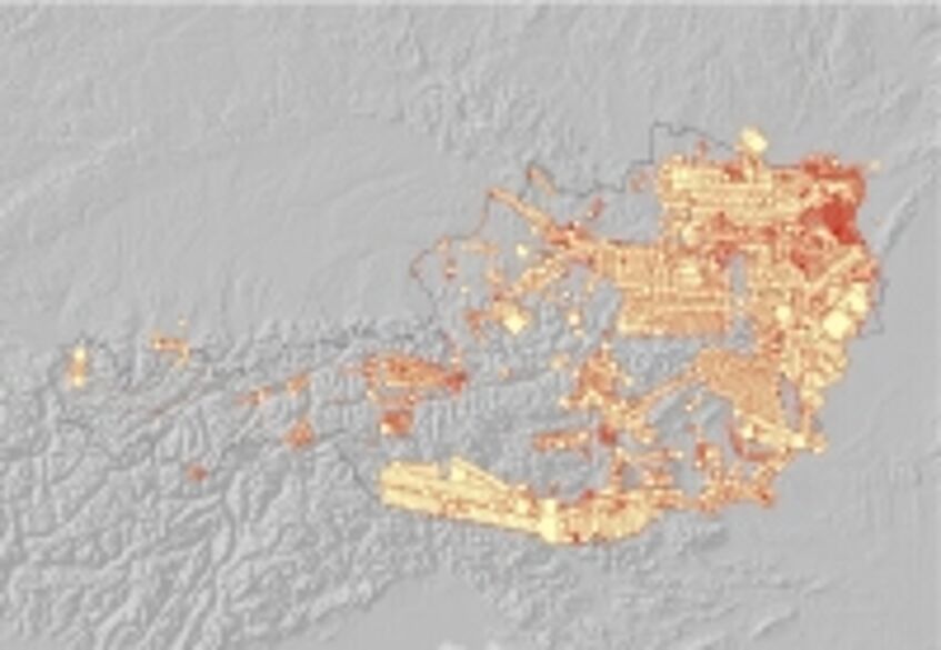
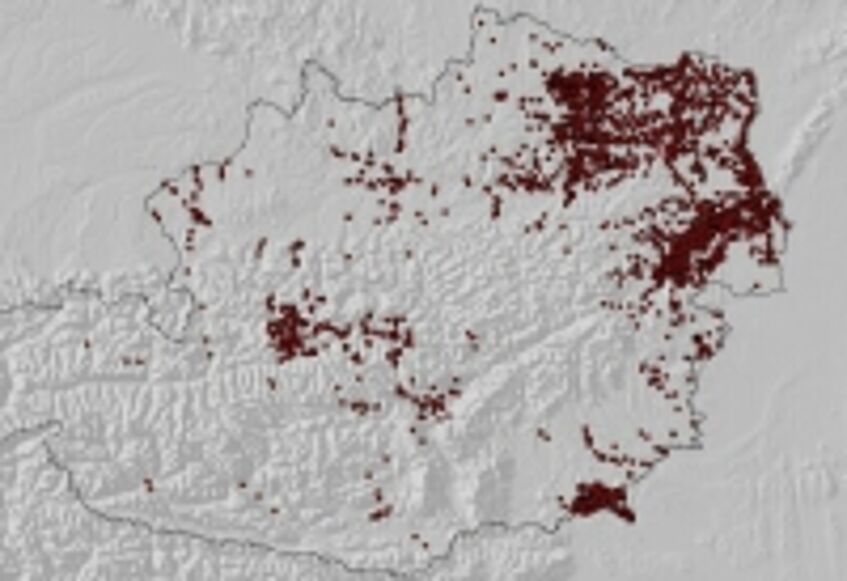
The visibility of archaeological structures depends on many factors; thus the same site is presented in different clarity from season to season and year to year. The decades of collected experience have shown that aerial prospection reaches its full potential only when large areas can be overflown systematically and repeatedly. This has allowed us to document around 450 archaeological sites in a 600 square kilometer area along the Leitha river south of Carnuntum.
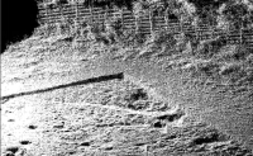
While flying, an archaeologically trained investigator looks with their bare eyes for archaeological traces and documents them from the plane with a digital camera. Because of the angle from the side window, these images are called oblique photographs. The sites are marked on a map or, if available, saved with a GPS tracker and then later integrated with the flight path in a geographical information system (GIS).
Roman terrain system near Foggia / Italien
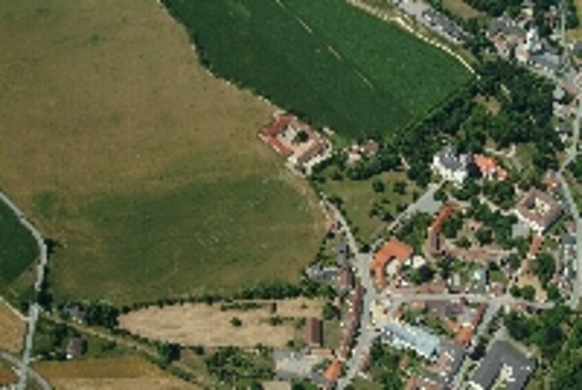
Baroque garden near Asparn
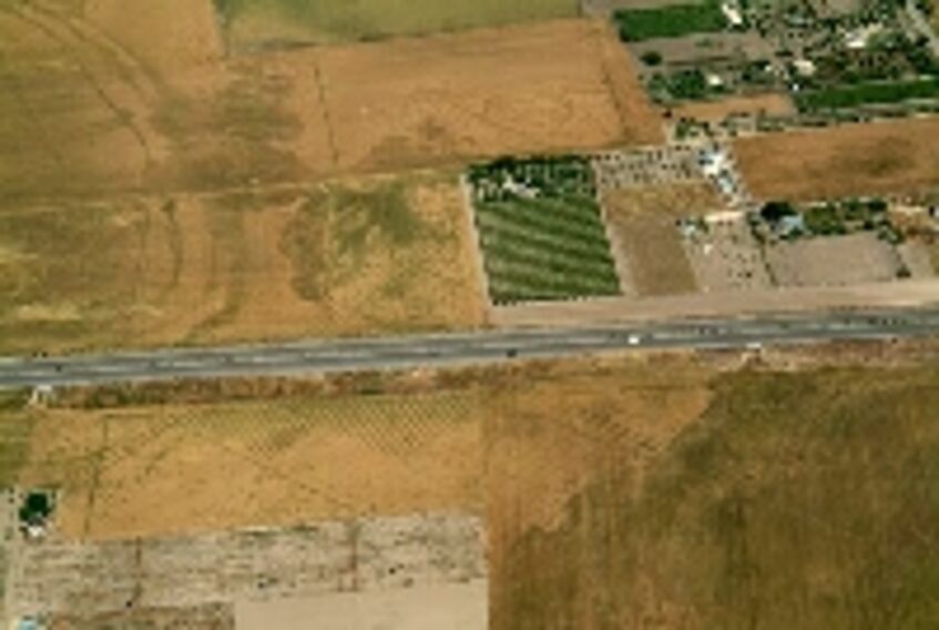
Roman villa near Pöttsching
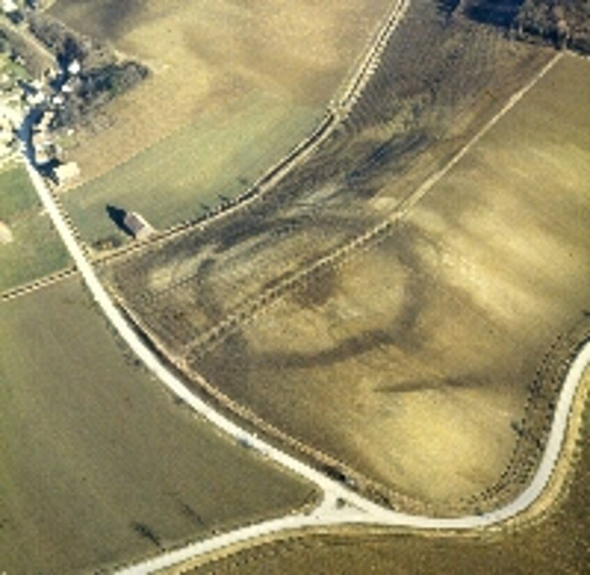
Circular enclosure in Friebritz
But not only aerial archaeologists create aerial images. Also the aerial photography company of the Austrian Air Force works closely with archaeologists. They take vertical photographs with specially designed military aircraft that have a cartographic camera mounted on the underside facing straight down. These photographs are produced in serial images: The airplane flies in a meander above the area to be documented and the individual images overlap so that they can be viewed stereoscopically and evaluated in three dimensions. The high resolution of such serial cameras allow archaeological traces to be localised and recorded down to the decimeter from 1000m altitude.
Archiving
The collection of the Aerial Photography Archive is archived in a GIS. A database based on ArcView was constructed specially to archive our aerial photographs and the archaeological sites. Because the scale of the images is known, they can be used to calculate the area covered by a photograph, which is invaluable particularly when linking with other data. This makes it possible using an algorithm to quickly generate a list of all known find sites located within the area depicted and saved within the respective files. It is also possible to output all the existing aerial photographs of a specific KG or a specific area. The entry of all images in the Aerial Photography Archive, both slides and prints on paper (around 120,000 images), was completed in 2006 thanks to the financial support of a focus project. We are currently in the process of digitizing all aerial photographs, which will take another couple years to complete.
Aerial photographs in the archive
Sites found in aerial photographs
Interpretation and Mapping
Aerial archaeologists not only create and archive aerial photographs; an important aspect of their work lies in evaluating these images using the latest technology. The archaeological interpretation of the images usually goes hand in hand with mapping them in a geographic information system, the goal of which is to interpret the archaeological content of the aerial photograph and to display the images in a plan that is understandable and to scale.
In the course of interpretation, the individual recognized characteristics are isolated, evaluated and traced or charted. It has proven advantageous as a first step to deskew the selected aerial images and then execute the rendering within the GIS.
First, the images must be corrected for geometric distortion caused by the angle at which the photograph was taken, differences in height at the ground level, or camera lens distortion. The images are deskewed using the latest digital photogrammetric methods. This allows the overlapping vertical images to be used to generate a highly precise digital model of the terrain from which contour maps can be calculated. The terrain models also serve as the basis for the automated digital production of rectified vertical and oblique images, so-called “orthophotos”, which have a uniform scale and thus the quality of a map.
Compared to the conventional maps which were previously produced in the course of evaluating aerial images, orthophotos have the advantage that the entire image area serves as the basis for a map. They can be overlapped with other images and their interpretations of the same area, which makes immediately visible connections between the archaeological structures recognizable in the orthophoto and the features charted using other aerial photographs.
Interpretations can thus be made directly on the digital image. Orthophotos also serve as a basis that can be combined with other types of digital plans (cadastre, excavations, etc.) and aerial renderings. The actual detailed interpretation is the most time-consuming aspect of the work, since, as part of an iterative process, the charted finds must be compared continuously to newly added information, evaluated in light of new details, and if necessary re-interpreted.
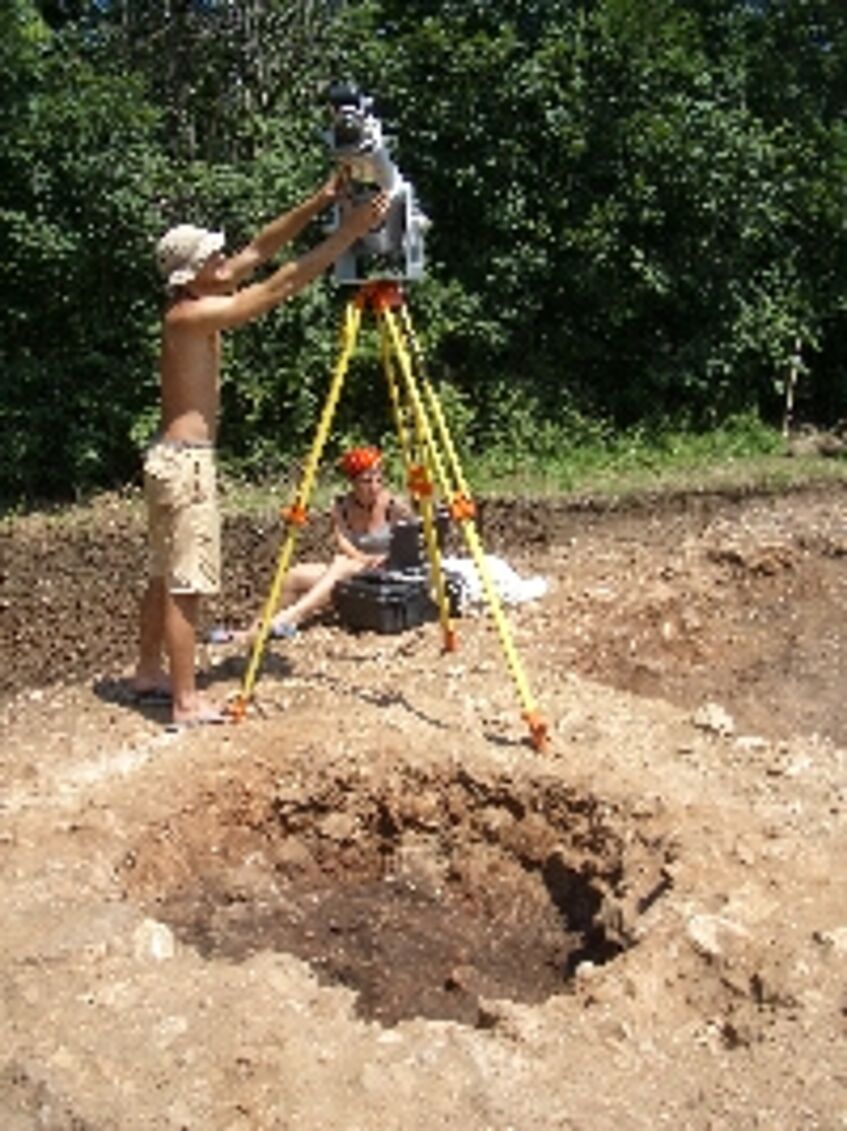
Excavation documentation
A further research area is the latest digital documentation of archaeological excavations by implementing the most recent total stations as well as terrestrial 3D laser scanners and photogrammetric techniques. See for example:
Doneus M., Neubauer W., 2005. 3D laser scanners on archaeological excavations. In: Dequal S.: (Ed.) Proceedings of the XXth International Symposium CIPA, Torino 2005. The International Archives of Photogrammetry, Remote Sensing and Spatial Information Sciences, Vol. XXXVI-5/C34/1, 2005, 226-231.
3D Laser Scanner
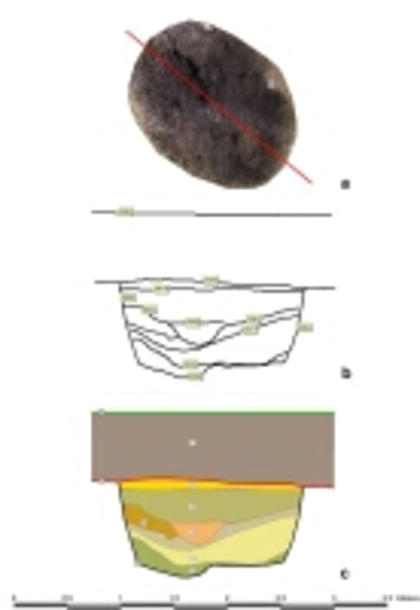
Virtual profile through a pit
Data from a laser scan
Digitally documented layer